Tuesday, 9 July 2013

Ascent of Whernside from Ingleton

Sunday was such a gorgeous day so I decided to drive over to Ingleton and walk up the long southern ridge of Whernside from Ingleton in the Yorkshire Dales. It takes about 90 minutes to drive there from Hebden Bridge and I set off at about 10.30 am. I had planned to walk up Oddie's Lane and follow the route described by Wainwright as Walk 7 in his 'Walks in Limestone Country", my copy of which is an heirloom with my mother's annotations. However, it was convenient to park in the Waterfall Trails car park and having paid my £6 I thought I might as well follow the trail with a slight detour of about 9 miles to to take in Whernside. This makes the whole walk about 14 miles (24 km) and 2000ft (600m) of climbing.

The Ingleton Waterfalls Trail is beautiful as it weaves up the River Twiss and cuts across the hillside.

Waterfalls on the River Twiss


A ray of sunshine lights up a rock below Thornton Force
On up the hillside to meet the Limestone Pavement at Twistleton Scar leaving the Ice Cream Vans behind.
Looking across Limestone Pavement at Twistleton Scar towards Gragareth
The navigation is then incredible easy as you follow the wall for about 4 miles to the top of Whernside. It's hard to imagine how much work went into building a dry stone wall like this.

Wall to Whernside
I met a few groups with huge rucksacks. A very hot day to be doing your Duke of Edinburgh expedition I must say! Otherwise, most people on the top had come up from Ribblehead. I eat my lunch at the top and headed back the same way. Wainwright sugessts a different route back through Bruntscar but I felt that it was nicer to be high up.

On the way back I looked for the 'Fluted Pothole' he'd sketched but it could be one of many.

A Fluted Pothole.
Just before rejoining the Waterfalls Trail along the River Doe it became a little less hazy and Ingleborough looked great with the Limestone Pavement in the foreground.

Ingleborough from Twistleton Scar
Back in Ingleton they were having a World War II Retro day with people singing that there'd be Bluebirds over the White Cliffs of Dover but just before I got back into the car to drive home with the thermometer showing 26 degrees Centigrade I caught the sound of a Stone Chat on the Limestone Pavement of Whernside!

Friday, 14 June 2013

Rock Engravings in Valle Camonica

A couple  of weeks ago we were staying near Lake Iseo in Italy and we visited some of the Rock Art in Valle Camonica. We saw those at the Naquane National Park in Capo di Ponte.

Some of these engravings are Neolithic (about 7 thousand years old) but most are Iron Age (about 3 thousand years old). There are human figures, animals, household objects, architectural and mechanical structures as well as hunting scenes.

Most were created by repeatedly hammering a spike into the rock and building up the picture with a series of small indentations but some are scratched.

They are well presented; with explanations on noticeboards in Italian and English as well as steps and platforms so that you can get close to the drawings. It is effectively an open air museum.

http://www.reidsitaly.com/destinations/lombardy/lake_iseo/valcamonica.html


I particularly like the chariot or cart (above) because the wheels and horses are drawn side on whilst the rest is an aerial view. I also like the running man (below)


However, there seemed to be tendency to represent a lot of the drawings as religious. I'd like to see the evidence for this. Why is the running man called a priest? I can see he's a man!

Why are these people supposedly praying? Aren't they dancing?


For what it's worth, this one reminds me of Scottish Crannogs.


However you look at it though, you really get a feeling of going back in time. Highly recommended.


Monday, 20 May 2013

Freshwater Bay


It was Sunday evening and it was a very nice feeling to have led an HF Party for the first time for nearly 28 years. I have just completed a weeks leading at Freshwater Bay HF on the Isle of Wight. The Sunday 'Medium' walk went from the house, over to Colwell Bay, along the North Coast to Alum Bay and the Needles and then back over Tennyson Down.

There was a sponsored walk to raise money for the local Hospice that involved about 10,000 people in various walks, one of which crosses the whole island from East to West (26.5 miles from Bembridge to the Needles at Alum Bay). The weather was good to start with but deteriorated later on and some of the sponsored walkers must have got pretty cold and wet on Tennyson Down.

The Needles


On Monday it was windy on the 'Harder' walk as we followed the horseshoe made by the downs above Godshill and Appuldurcombe House but the views were superb across to Sandown.

Sandown from the Downs above Ventnor
This tree gives you the impression that it is often Windy!
Interesting talk about Red Squirrels in the evening.

On Tuesday the 'Easier' walk followed the Coastline in an Easterly direction into Cowes. The weather wasn't great but we visited the Max Aitken Museum, the Classic Boat Museum and Gallery all of which were interesting. 

The next organised walk was on Thursday from Ventnor Gardens to Shanklin along the Coastal Path. Landslip has caused a lot of re-routing of the path and this makes the walk a lot more strenuous than you'd think from the map. The weather was glorious though.

Ventnor Gardens
Various shades of green algae along the Promenade
On Friday I led the 'Easier' walk from the House to Yarmouth and back alongside the river Yar. This has a large estuary but is only about 3 miles long because it used to start in France! Lot's of tea stops made this a leisurely way to round off the week.

Freshwater Bay from the HF House Gardens
During the week, in the evenings, we'd had quizzes and games and we finished up with a bit of Country Dancing and a Concert with high levels of participation from the Guests making every evening a fun social occasion.

The Isle of Wight may not offer particularly challenging walking but it's very beautiful and not everyone goes on holiday to wear themselves out you know!

Sunday, 20 January 2013

Fewston and Swinsty Reservoirs

My dad, Keith, has just had a knee replacement in Harrogate hospital so, on our way to visit him, Dot and I thought it would be nice to walk round Fewston and Swinsty Reservoirs.


View Larger Map

It has been snowing and the partly frozen reservoirs looked fantastic.


It takes about two and a half hours to walk round both reservoirs and there is an excellent path. So good to get out.


Keith's operation seems to have gone well although unsurprisingly his knee hurts. On returning home I had my letter from HF saying they'd have me back as a leader. what a brilliant day.

Thursday, 3 January 2013

Leading for HF Holidays - Then and Now

A couple of weekends ago, following my application and a telephone interview, I was invited to attend an HF Leaders 'Guidelines Assessment' to see if I still wanted to be an HF Walks Leader afterwards. Oh, and to see if they wanted me as well :-) It was at Derwent Bank near Keswick. We went out walking each day and talked about the way HF Holidays are organised, in the evening. There were guests enjoying a 'Tinsel and Turkey' holiday at the same time giving us the opportunity to get a good impression of how things worked. As usual with HF the food was superb.

This is not the first time I have stayed with HF. As a family we have been on several HF holdays over the years. Normally, when you go out walking with children you have to work hard to keep morale up but on an HF Family Holiday they meet other kids and they don't even seem to notice that they are out walking. I also used to lead walks for HF Holidays in the 70s and 80s.

When I was 18 and waiting for my A Level results I didn't want to hang around the house in South East London and I managed to get a job working as a Kitchen Porter at a Countrywide Holidays Association (CHA) Guest House in Onich near Glencoe called Craig Mhor. It isn't owned by CHA any more but I had a great time there going out walking with the Guests on my day off. The people leading the walks were called Secretaries. This harked back to a time when their role included collecting the balance of peoples' Holiday Payment.

Evelyn the Cook doing my job as I 'supervise' my boss. (Posed 1976)
The CHA was founded in 1893 by the Rev. T. Arthur Leonard who came from Colne in Lancashire. The organization was originally known as the Co-Operative Holidays Association, and was set up to provide walking holidays for working people, especially from industrial areas like Blackburn and Manchester. In 1913 he left the association to form the Holiday Fellowship, now known as HF. In the early 1950’s the name of the Association was changed to the Countrywide Holidays Association.

Meanwhile, back in Onich, I felt that it would be more fun leading walks than washing up so I went for an interview at Birch Heys, the CHA Head Office in Manchester, and armed with references from the Secretary and the Manager, I was given a job leading walks from Craig Mhor the following season. I wasn't totally inexperienced I hasten to add. I had done plenty of walking, climbing and navigating with my parents and in the Scouts. 

Staff at Craig Mhor 1976 with me on the right
I was there for the whole season - May to September. They had a three week programme of walks, and highlights included completing all the Mamores in a day on my day off as well as leading parties on Curved Ridge, Buachaille Etive Mor, Aonach Eagach and the Ben Nevis Arete. No organisation today would let a 19 year old with no walking qualifications lead parties on these scrambles but everyone who came was perfectly capable and there were no accidents.

50 on Sunday Morning Walk - Beinn an Aonach Mhor 1977

Aonach Eagach 1977

Bidean across Loch Leven 1977

My old rucksack on Aonach Beag looking at Carn Mor Dearg 1977
The world has moved on since and that's why I have obtained my Mountain Leader Award and attended this HF Holidays selection weekend. It is absolutely right that people going on holiday should have a competent leader and walking organisations need some mechanism for making sure of this. I do not believe that we should be making walking in the hills risk free but people need to be able to properly understand any risks they are taking and have some idea who is leading them.

Loch Leven and Sgurr na Ciche (aka Pap of Glencoe) 1977


Party on Am Bodach Ridge Led by Peter Wilson 1977

Stob Ban Ridge then Sgurr a Mhaim then Grey Corries at the back 1977

The following year I again led walks for CHA from their house in Grasmere. I was a student at Warwick University by then but I still had the extended student holidays from July to September. There was a two week programme of walks that included nearly all the major peaks and some delightful shorter walks in the beautiful Lakeland valleys. I always felt that the easier walks in Glencoe played second fiddle because the harder "A" walks seemed to have been planned first, then the middle "B" walks. With the easier "C" walks having to be found somewhere in the same area - as everybody used the same coach on most occasions. There were som notable exceptions of course; Lismore Island, Steal and Coire Gabhail (aka Hidden/Lost Valley) being examples. At Grasmere however there was a lot more choice. Sometimes the groups were too large and even with a backmarker it was hard to keep track of everyone.

Grasmere 1978 with me on the left

Grasmere Sunday Morning Walk Alcock Tarn 1978

Party of 37 coming down to Threshwaite Mouth 1978
I remember having to call the Mountain Rescue Team once when a gentleman in one of these larger groups 'vanished' on the Ill Bell to Yoke ridge. We stopped in the mist and and I counted the group. A few minutes later I counted again and we were one down. We searched for quite a while but in the end we all carried on down to Troutbeck and I called 999 from the Phone Box. The house management and I had a fretful evening but he turned up safe and well. He had stopped to put his overtrousers on without telling anyone. When he found he was all alone in the mist, he just headed for the valley.

In 1979 I switched to leading for HF Holidays and returned to Glencoe. Alltshellach near Ballachulish is a beautiful old house on the shores of Loch Leven. I led all the old walks from two years ago for another student summer holiday. TA Leonard supposedly quit CHA to form HF because CHA had become "too middle class" but I remember HF being quicker to replace Lino with Carpets and even to introduce some en-suite bathrooms! Although the 'race for the bath' as you got off the coach and the politics that surrounded it was an interesting feature of any holiday. I think it was this willingness to move with the times that helped HF carry on while CHA declined.

Na Gruagaichean from Sgurr Eilde Beag
When I finished at University I became a Secondary School Maths Teacher and for several years I carried on leading for HF at Conway (1980), Loch Awe (1981), Arran (1982), Coniston (1983) and Derwent Bank near Keswick (1984 and 1985). This included a Music Week and a Scottish Country Dancing week where people only walked in the afternoon but in both cases had a propensity to start singing or dancing whilst out on the walks! Good times.

Cir Mhor from Glen Rosa (Arran 1982)

Sunday, 4 November 2012

Autumn Colours in Crianlarich

Dorothy and I stayed in a self catering cottage just North of Crianlarich. It was very cosy with a wood fire. The objective was to 'bag' a few more Munros but, as it turned out, this was not going to be easy. Somehow, when I was putting the clocks back, I managed to put my mobile phone (aka Alarm Clock), back two hours instead of one so we started off up Beinn Cabhair an hour later than we'd intended to. To say that it was wet and boggy would be an understatement and it was pretty cold on top. We ended up finishing the walk with our head torches on. So day one was a bit of an adventure.

Ptarmigan on Beinn Cabhair
When Night Navving (see earlier blog) on a moor, a head torch is very effective but when you are trying to find your way down a steep path in the rain it is is hard to tell the difference between small streams and the wet path.

The next day - Monday - we set off as soon as daylight started at about 7 am. We climbed An Casteal and Beinn a Choin via the North ridge of An Casteal, returning along the river Falloch. The weather was excellent, if a little cold and there was a snow flurry towards the end. Great views in all directions.

On Tuesday we tried to climb Stob Binean from Benmore farm. A few years ago we climbed Ben More but had to turn back from Stob Binean because the weather was so bad so we were keen to complete it this time. The forecast was light rain in the morning and heavy rain in the afternoon. So we hoped to get it done in the morning, by setting out at the crack of dawn again. We were about 30 minutes from the top when we decided we had to turn back. Snow, hail and sleet was combining with increasingly strong winds and when you started to head back down it was more difficult. The ground looked as if someone had emptied wallpaper paste all over it and I could imagine this slush freezing and becoming very treacherous.

Back at the bealoch (col),  behind a large rock, we were joined  by three other people who also agreed that it was time to head back to the valley. We had a chat with a digger driver at the bottom who had previously been a contract shepherd. He explained to us how villages like Killin were in decline. It seems that what has happened on many of the Hebridean Islands is now recurring in the Highlands. Less and less young people want to live there because of the lack of amenities and less and less old people because all the local hospitals have closed. Very sad.

The forecast for Wednesday was grim so went for a valley walk up Glen Ogle and back to Lochearnhead via the disused railway line. The latter part was fantastic, with the railway line hugging the side of the glen you get excellent views and wonderful mosses in the railway cuttings but the former part was in a poor state. As we left Lochearnhead there was a map announcing the Glen Ogle Trail. It looked as if it had been created at the Millenium but not very well maintained.

Mosses alongside the disused railway line
In my day job working with IT Systems for a Bank, we have a concept of Service Management. It isn't enough to just build a computer system to provide a customer service, you also have to think about how it will be maintained in the future. It will need to be monitored and updated regularly. Unfortunately, all too frequently, this concept does not seem to be applied to footpaths.

Glen Ogle disused railway line
On Thursday we climbed Bem Vorlich from just South of Ardlui over 'The Liitle Hills' and back via the North ridge. Route finding was tricky in the snow but the views over the clouds of the snow capped hills and down at Loch Lomond were brilliant.


Loch Lomond on the way up Ben Vorlich
With more heavy snow forecast, we went for a drive on the Friday round to Lock Arklet and Inversnaid. We drove round through the beautiful Trossachs with their autumn colours and from just above Inversnaid you could look across at Beinn Narnain, Ben Ime, Ben Vane and Ben Vorlich where we had been the day before. A wonderful viewpoint.

View across Loch Arklet of Beinn Narnain, Ben Ime, Ben Vane and Ben Vorlich 
We eat out at the Crianlarich Hotel and drove home on the Saturday. A haul of four Munros is not great for a weeks walking but we experienced some incredible weather conditions and the colours at this time year in the Highlands are truly amazing.
View across Loch Lomond of Beinn Narnain, Ben Ime, Ben Vane and Ben Vorlich

Sunday, 21 October 2012

Plenty of Grouse at Millers House

Dorothy and I decided to try out one of the TGO Wild Walks from the November Issue. We started at Tower Lodge in the Forest of Bowland (SD614539) and set off North along a nice track. We immediately encountered a very ambiguous notice saying that there was going to be shooting on the Open Access Land and that we had to stick to footpaths. There was a very confusing map with different colours showing where the Open Access Land was. As our route was mainly on footpaths and seemed to follow the edge of the coloured area we decided to press on and see.

We turned East across White Moor following a concessionary footpath, although there wasn't really a path as such. These footpaths are a bit like the equator, imaginary. That reminds me of an old joke about the boy who thought there was a dangerous animal that circled the globe. A menagerie lion running round the Earth. Never mind...
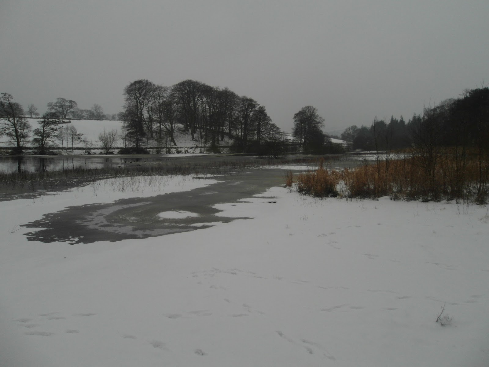
On the way over to Millers House we could hear the hunting dogs. They sounded as if they were a couple of miles to our West so we felt reasonably happy that we weren't disturbing the shoot. In fact it was easy to imagine we ourselves were being hunted. When we stopped I put on my dark fleece to keep warm but it was going through the back of my mind that it also made me less visible.

At Millers House we stopped for elevenses next to a large millstone. It seems very unlikely that this was really a Miller's House. It's hard to imagine a less favourable spot for grinding wheat to make flour. You'd have to carry the wheat there and carry the flour back. Maybe it was less boggy then, but a more likely explanation is that this was where people made the millstones. After all, the rock here is Millstone Grit.


You'd still be left with the problem of getting the stones from here to where the miller really lived. You could put a pole through the middle and with a couple of people each side perhaps you could roll it down. Even if it where less boggy it would not be easy. Just making it in the first place must have taken an incredibly long time! Hats off to anyone making a living out of this.

We headed North and West to Wolfhole Crag. The shapes and colours made by the moss, the heather and the water are fascinating. Take this green pool for example. As the path is largely imaginary you need to concentrate on route finding. This could be fun in thick mist!


The sun came out while we eat our lunch at Wolfhole Crag and enjoyed views of Ingleborough and the Trough of Bowland. From here we went West and met some beaters. "Where are you going?" we are asked politely. "Over to Wards Stone" I said. I'm not sure they knew where I meant but we are asked to keep on the South side of the wall as they were shooting to the North. "No problem" I replied. Not sure they were happy to see us though!


Now the shapes and colours were dominated by the peat itself. The peat could be incredibly black like oil or a rich purple like the heather. With peat hags dominating the skyline.


From Wards Stone, the highest point in The Forest Bowland (580m), apart from the trig point a kilometre away that's a metre higher, you can see the Carneddau in Snowdonia and the Lakeland Hills. The TGO article suggested you could also see the Isle of Man but it was too hazy for that.

We dropped down to the gravelled track to the south of us and started to head back to our car but then we met the shooting party. Again these were beaters but they didn't want us carrying on into the area they were beating. After an amicable discussion we agreed to take a detour round them although I must admit I did find the concept of the moor being closed quite amusing. For a minute I thought the gentleman we spoke to had the wrong consonant. I can see how you can close a door but a not moor?

Anyway we all need to share the countryside and we'd had our walk while they had their shoot so no worries as far as I was concerned. It seemed like very well organised operation and I guess it needs to be. One is inclined to think 'poor birds'. However, I'm not a vegetarian although I try to eat free range food if I can. I guess it doesn't come much more free range than this. 


On the way back we saw a beautiful sunset over the mouth of the Mersey and the Dee. We rarely come to this area but you could easily be walking in the Highlands of Scotland and it's only an hour's drive from where we live. Up on the top it reminded us of another walk we did between Mayar and Driesh above Glen Clova. Only that, believe it or not, was a lot more boggy!